The Purchase
McCracken was the first county in glass. Its neighbours come next, so the region around it was made ready before a single one of their parcels arrives.
From one county to the next
quick question about data. did we get the roads from the county GIS or did we get roads from somewhere else?
Sep 30, 20:55
Somewhere else. McCracken’s roads came from the Census Bureau, which publishes every county’s roads in the country in the same form. So the next county’s roads were a download away, and so were the next ten.
so can you go get the other counties then?
Sep 30, 20:56
doesn’t this, along with lidar, mean we’ll be able to tron the whole f—ing jackson purchase area?
Sep 30, 20:57
It did.
Counties first, parcels later
The plan got its name a few minutes later:
adding other counties, excluding parcels, in anticipation of PVA / parcel info on each county later
Sep 30, 21:10
Everything a page needs to draw a county, except its parcels. Then when a county’s parcel file comes in from its valuation office, it drops into a picture that’s already lit, instead of starting from a blank map.
The region was “8 jackson purchase counties and lbl counties”: Ballard, Calloway, Carlisle, Fulton, Graves, Hickman, Marshall and McCracken, and around Land Between the Lakes, Livingston, Lyon and Trigg.
Roads past the edge
Light that pours in from a region’s edge needs roads that run past it. So the roads came from 26 counties: the eleven and their neighbours, across the rivers into Illinois and Missouri and south into Tennessee, clipped a mile beyond the region’s line. A road on a county line is in both counties’ files; 124 of them were kept once.
Checking the older files turned up one surprise. A folder meant for Stewart County, Tennessee, home to the southern half of Land Between the Lakes, held Sumner County, near Nashville. Every source file is now listed with its fingerprint and checked against the original before anything is built from it.
Four rivers
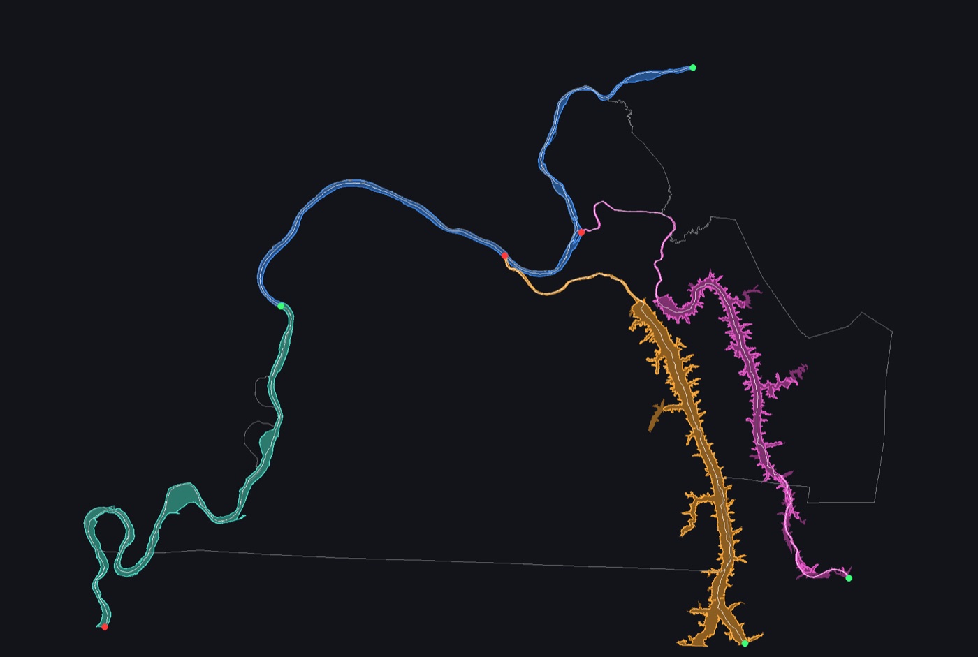
The rivers came from the U.S. Geological Survey’s detailed water maps. Each river is its main channel and the water it runs through. Kentucky Lake and Lake Barkley keep their arms. The rivers run ten miles past the region, so the light can fade out instead of stopping at a line.
Two things needed fixing. The survey draws some creek mouths in the same shape as the river, the Clarks with the Tennessee for one, so anything narrower than about 300 feet is trimmed off unless it’s the channel itself. And below Barkley Dam the Cumberland narrows to about 700 feet, which broke its banks into four pieces until the channel was always kept.
A rule caught by its own log
A rule meant to carry each river across its dams was quietly turning land into water at Kentucky Dam, Barkley Dam and a few causeways. It only showed up when every fill was logged with how much of the river’s channel it covered: none. The channel already runs through each dam’s lock or spillway. Now the rule fills only where the channel itself leaves the water, and here that’s nowhere.
The lesson went into the notes: log every automatic fix, with where and how much.
The ground from the air
Kentucky flies the whole state with LiDAR, a laser that measures the ground from a plane, and publishes it. McCracken has three flights at two-foot detail. The region got two flights at eight feet, plenty for a view of eleven counties.
The years in the state’s file names aren’t when the plane flew, so the flight dates came from the time stamped on the laser points themselves. The two flights are named for what they really cover, 2011 to 2018 and 2019 to 2021. All 8,814 source tiles match the state’s copies byte for byte.
Some ground came out below sea level, and that isn’t an error. Livingston and Lyon have limestone quarries dug far deeper than the rivers; the deepest, near Grand Rivers, reaches about 85 feet below. Six such pits are listed, with a check that finds them again. The newest flight, from 2026, waits until the state has published more of it.
Written down, to run again
remember we’re keeping a playbook so all this merging and smoothing is documented and repeatable
Sep 30, 22:43
Every step has a line in the region’s playbook: what it does, its numbers, and why. Each check has its expected result. It also says what to do when a new year of roads comes out, when the water maps get a new release, or when the region changes. The whole build runs in under two minutes, so running it again is cheap.
That last part mattered sooner than expected.
it’s going so well, we’re planning to do the whole state
Sep 30, 23:42
- Where did the roads come from?
- Other counties, excluding parcels. The region decided.
- Build the region.
- Counties, seats, roads and places delivered.
- The rivers, with the creek mouths trimmed and the dam rule fixed.
- “We’re planning to do the whole state.”
- The ground from the air, every tile checked.